EXPEDITION LOG
EARTHKIND · FALL GATHERING 2026
FRAME 01 / 12
Earth photographed from the Orion spacecraft

Image: NASA · Artemis II

CH-01 · Ocean swell0.1 Hz
● Not in the model
CH-02 · Atmospherevar.
● Not in the model
CH-03 · Biospherepulse
● Not in the model
CH-04 · Lithosphereburst
● Not in the model

The problem

AI needs the right data and expert checks.

Ask Claude or ChatGPT where to protect biodiversity next, or whether a mountain slope will slide tomorrow. Without local data and expert checks, you can’t reliably use the answer.

Models learn from the data that is cheapest and easiest to reach. Earth data comes from hundreds of groups, kept hundreds of different ways.

Our response

A Common Crawl for Earth data

  1. 2007

    Common Crawl is a free, open 12PB archival copy of the web.

  2. Since

    Thousands of research studies, then today’s chatbots, were built on it. The Foundation of Modern AI.

  3. Now

    PI Pod is building the same for Earth data: a digital library, and an index to find it.

Keep your data your own way. Mirror a copy into the commons.

Marin logo

The library adapts the open framework from Marin, a project led by Percy Liang of Stanford HAI’s Center for Research on Foundation Models.

Common CrawlResearch papers citing Common Crawl
12,000+cumulative, 2012–2026
3k6k9k12k 2020 · GPT-3,82% training tokens came from Common Crawl 20122014201620182020202220242026

Source: Common Crawl, Google Scholar citations to 2026

Today

Three parts

  1. 01

    Where we are. The road, and what the avalanche experiment has shown so far.

  2. 02

    Where we’re going. Find Earth data and learn from similar places.

  3. 03

    What would help us get there. What stands in the way, and how you can help.

3 Paths, One Road

Earth data is anything with a place. Today every team collects and aligns it from scratch. We align it once, openly, so places that look alike can learn from each other.

Growth & Innovation Horizon 1 · Now Horizon 2 · Bridge Horizon 3 · Future 1 2 3
H1

UAC experiment

Prove it on avalanche forecasting in Utah.

H2

Multimodal Training Dataset

Layer in more Earth data: what we learn from Planet’s daily imagery, Common Crawl web pages, Earthkind datasets.

H3

A shared Earth-data library

Proposed: E3C Data Consortium

Open data and tools to find records and learn from similar places. Not built yet.

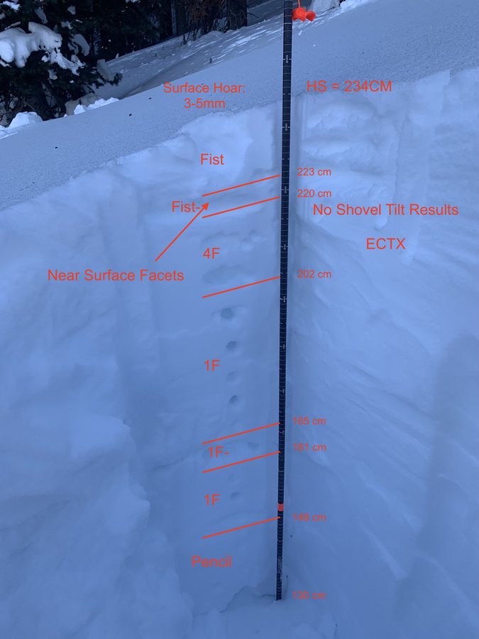
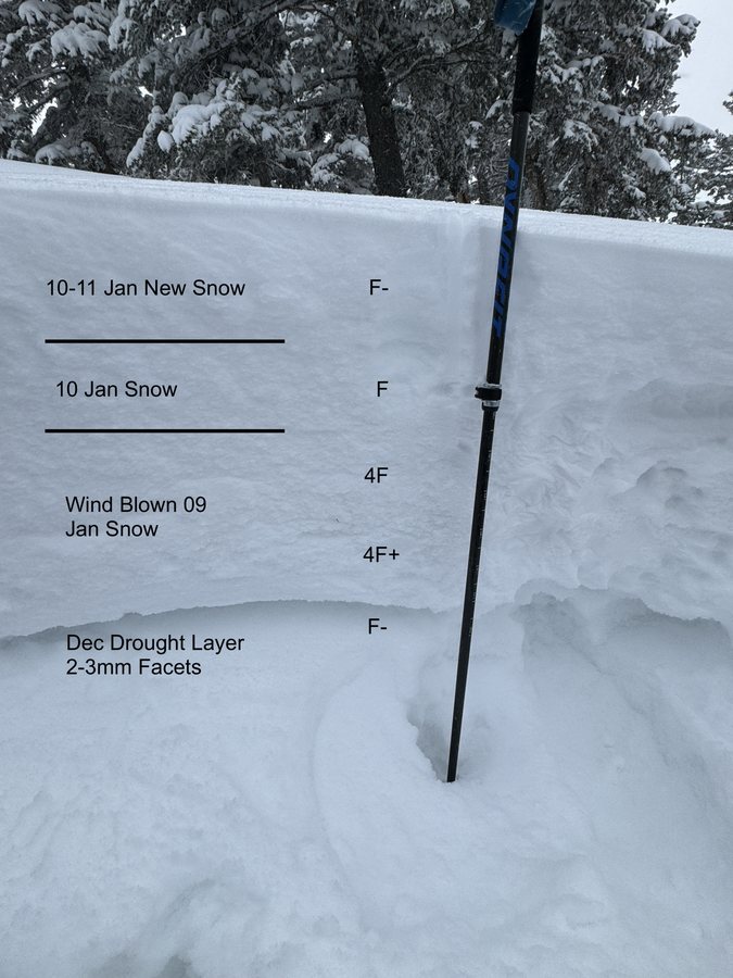
Silks Basin snowpit · Jan 2023
Murdock Peak profile · Feb 2023
Card Canyon weather station · Dec 2024
Mill Hollow weather install · Dec 2024
Summit Park avalanche · Jan 2024

UAC experiment · The field test

Can open, aligned data match UAC’s forecasts, and does daily satellite imagery make them better?

Input · ground13 open datasetsweather, snow, terrain, avalanche records & public satellites
+
Input · orbitDaily imagery (Planet)yet to be tested
MeasureForecast skillagainst UAC’s own ratings

Photos: Utah Avalanche Center

UAC experiment · The data stack

One patch of ground,
every source

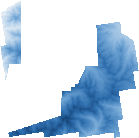
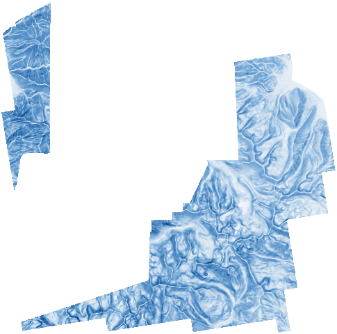
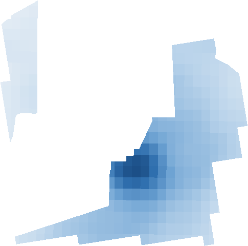
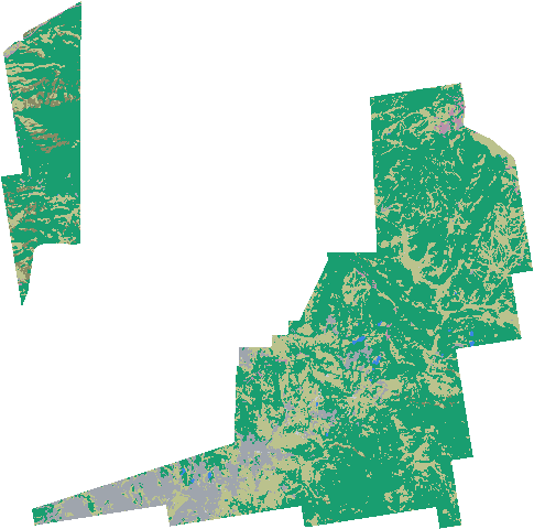
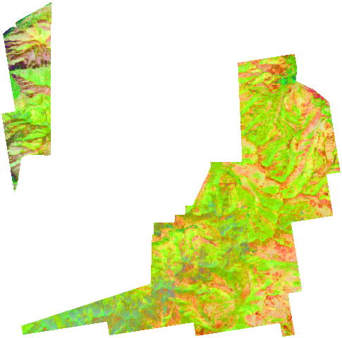
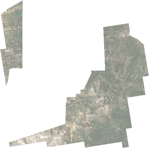
Every source is resampled onto the same 50 m grid over Little Cottonwood, Big Cottonwood and Mill Creek canyons.

Weather drives a snowpack model in every cell. Terrain, land cover, satellite photos and satellite radar describe the ground it sits on.

Weather model (HRRR)3 km
Satellite radar (Sentinel-1)10 m
Satellite photos (Sentinel-2)10 m
Land type (Earth-model biomes)80 m
Land cover (ESA WorldCover)10 m
Rain & snow (MRMS radar)1 km
Slope50 m
Laser-mapped terrain (lidar)50 m

UAC experiment · Datasets

From long list to pipeline

Every source we’ve looked at, sorted by how far it got.

8In useFeeding the pipeline now
NOAAUSGSUSDA NRCSESA · CopernicusUtah Avalanche CenterUGRCSnowPilotMicrosoft Planetary Computer
10TestingPilots & experiments
NASAISROGoogleMetaIBMOpenStreetMapUniversity of CambridgeClaySLFPANGAEA
4Under analysisStill deciding
PlanetCommon CrawlECMWFUDOT
14ReviewedKept for later, or passed
Source CooperativeSynopticAvalanche CanadaCAICNACNVEGDELTOpen-MeteoVisual CrossingmeteoblueMeteomaticsUmbraICEYECapella
25+ConsideredOn the landscape map
JAXA · CONAE · iNaturalist · eBird · OBIS · BOLD · Xeno-canto · Global Fishing Watch · Maxar Open Data · Hugging Face & more

Ten winters · 7 UAC forecast regions · ↓ drill in by organization

Datasets · 1 of 6

US federal science

In useTestingUnder analysisReviewedConsidered
NOAA

NOAA

HRRR · AORC · MADIS · MRMS · NEXRAD

Weather modelReanalysisStation networksRadar precipitationRaw radar volumesSatellite surface temp. passed
NASA

NASA

SnowEx · MERRA-2 · OPERA · Prithvi · ICESat-2

Snow field campaignDust & aerosols passedGround motion (InSAR)Earth foundation modelThermal & albedoIce & gravity
NASA · ISRO

NASA · ISRO

NISAR

L-band radar
USGS

USGS

3DEP · Landsat

Elevation, 10 mLandsat imagery
USDA NRCS

USDA NRCS

SNOTEL

Mountain snow stations

Datasets · 2 of 6

Utah & the snow community

In useTestingUnder analysisReviewedConsidered
Utah Avalanche Center

Utah Avalanche Center

Advisories · avalanche reports · station record

Daily forecasts & dangerAvalanche observationsWeather & snow stations
UGRC

UGRC

Utah Geospatial Resource Center

Lidar terrain, 0.5 mForecast zonesAvalanche path maps
SnowPilot

SnowPilot

snowpilot.org

Snow pit profiles
SLF · PANGAEA

SLF · PANGAEA

ESM-SnowMIP · Weissfluhjoch

Reference snow sites
UDOT

UDOT

Atwater · Little Cottonwood

Snowpack model runs keptAvalanche control records
Other avalanche centers

Other avalanche centers

Avalanche Canada · CAIC · NAC · NVE

Observation databases needs permission

Datasets · 3 of 6

Europe & global

In useTestingUnder analysisReviewedConsidered
ESA · Copernicus

ESA · Copernicus

Sentinel-2 · Sentinel-1 · GLO-30 · WorldCover

Optical imageryElevation, 30 m cross-checkRadar imageryLand cover
ECMWF

ECMWF

ERA5

Global reanalysis
University of Cambridge

University of Cambridge

TESSERA

Satellite embeddings
JAXA · CONAE

JAXA · CONAE

ALOS-2 · SAOCOM

L-band radar archives

Datasets · 4 of 6

Platforms & AI

In useTestingUnder analysisReviewedConsidered
Microsoft

Microsoft

Planetary Computer

Satellite data host
Google

Google

AlphaEarth · ARCO ERA5

Satellite embeddingsReanalysis mirror
Meta · WRI

Meta · WRI

Global canopy height

Tree canopy
IBM · NASA

IBM · NASA

Prithvi

Earth foundation model
Clay

Clay

Clay foundation model

Satellite embeddings
OpenStreetMap

OpenStreetMap

Roads, lifts, buildings

Map features
Common Crawl

Common Crawl

Horizon 2 multimodal dataset

Geo-tagged web text
Source Cooperative

Source Cooperative

Radiant Earth

Open data catalog kept

Datasets · 5 of 6

Commercial & alternatives

In useTestingUnder analysisReviewedConsidered
Planet

Planet

PlanetScope · Skyscraper · Stories

Near-daily 3 m imageryNews + imagery events templateImagery stories passed
Synoptic

Synoptic

MesoWest

Station API on hold
Weather APIs

Weather APIs

Open-Meteo · Visual Crossing · meteoblue · Meteomatics

Point weather history passed
Commercial radar

Commercial radar

Umbra · ICEYE · Capella

X-band radar passed
GDELT

GDELT

Global news events

News event feed passed

Datasets · 6 of 6

The long list for Horizons 2 & 3

Considered, not yet tested. Know one we’re missing? Tell us.

Biodiversity

iNaturalist · eBird · BOLD · Xeno-canto · Wildlife Insights · LILA BC · Map of Life

Oceans

OBIS · Global Fishing Watch

Genomics & eDNA

MGnify · NatureMetrics

Imagery & terrain

Maxar Open Data · OpenAerialMap · OpenTopography · SpaceNet · Radiant MLHub

Platforms

Google Earth Engine · Hugging Face · NASA Earthdata

Society & nature design

Our World in Data · WRI · EDGI · Ask Nature

Utah Avalanche Center logo

UAC experiment · The results

Since August 2026

  1. 01

    About as accurate as UAC’s human forecasters, using free public data.

  2. 02

    An improvement on UAC’s current snowpack model.

  3. 03

    Daily satellite imagery is the piece still to test.

UAC experiment · From stations to every slope

UAC today vs. our runs

UAC today
Planetary Intelligence
Snowpack runs
70 points14 stations × 5 slopes
83,232 cellsevery 50 m across 3 canyons, ≈208 km²
Run time
Hourly, per stationone danger rating per slope per day
≈90 min per seasonthe whole grid, on one GPU
Speed
SNOWPACK on CPU≈10 s per slope per season
≈1.6× fasterour engine, GPU vs 37 CPU cores (projected)
History
≈10 yearsstation records from about 2016
10 wintersrebuilt 2016–2026, 9 scored so far
Danger skill
+0.36 · +0.43automated ratings · human forecasters
+0.42from public data alone; reproduces UAC’s automated model on all 6,218 station-days

Skill = share of avalanche days caught minus share of quiet days flagged (Peirce score), 2025–26 season, 411 avalanches and 488 quiet days.

Next · beyond Utah

Earth-model biome map of the Wasatch Front

We plan to reach new regions through Earth-model biomes: places whose satellite fingerprint looks alike.

Wasatch 2024 · from 10 m GeoTessera embeddings, mapped at 80 m

How better data becomes a better call

From a reading to a decision

01

Data

Stations, satellites, snowpits. Thousands of readings a day, each one alone.

02

Information

Every reading aligned to one map: every slope, every 50 m, every day.

03

Knowledge

What the forecaster now sees between the stations that she could not see before.

04

Decision

The advisory that goes out at 5 am. A person makes it. The model helped her see.

Fewer people in the wrong place on the wrong day.

Utah Avalanche Center logo

UAC experiment · Route log

Where we are

✓ Done

Proof of concept

  • Ten winters of weather & snow data acquired
  • Snowpack model rewritten to run on GPU
  • Earth-model data aligned to every slope
● Current step · you are here

Experiments & validation

  • Running experiments
  • Validating the model against the forecast record
  • Bringing in more data & techniques
⚑ Next milestone · this ski season

A live test across UAC’s station network

Horizon 1 · Why it matters

Why the UAC experiment matters

  1. 01

    If it works, it becomes the proof of concept for H2.

  2. 02

    UAC proof of concept as the key that unlocks H2: Multimodal Training Dataset.

H1 · UAC experiment proof H2 · Multimodal Training Dataset

Horizon 2 · The Bridge

The Multimodal Training Dataset

NextBeyond avalanches: one grid, open from day one.

How PI Pod differs from Amazon.ia: open and free, anywhere on Earth, built from data that already exists.

Common Crawl logo
1place
2place
GDELTGlobal news events
3event

Web pages and news, about places

1 2 3 4 5 6 7 From above · Earth-model biomes
Day 1
Day 2
Day 3
4What changed, day to daynot the images
5Biodiversity podspecies
6Bioregional Resilience podwater & fire
7Regenerative Finance podfunding
8AI Horizonsmodel checks?
Wasatch, Utah Fingerprint The open library & index illustrative · not built yet Snow & avalanchesplace · timeWildfire historyplace · timeWater & river levelsplace · timeSpecies countsplace · timeLocal newsplace · timeCivic records: zoning, votesplace · timeLand & funding recordsplace · time A place that looks alike few records of its own Fingerprint Same fingerprint → reuse what was learned

Horizon 3 · Proposed E3C Data Consortium

Find Earth data.
Learn from similar places.

A shared library would line records up by place and time. Our hypothesis: similar places can reuse what was learned. The index isn’t built yet.

Horizon 3 · Like places, everywhere

From one key to a networked Earth

01 · Connect the US avalanche centers. Every one of them has the data. None yet has the map.

02 · …then centers worldwide forecast probability

03 · …then other natural hazards

04 · A networked Earth

Cross-coordination

How PI ties to Earthkind

EarthkindWhat PI brings
01WIT Strategy→ PI
  • Avalanches are a live crisis case. The root is a sensemaking gap: data exists, but decisions can’t read it.
  • PI builds the Knowing capacity: monitoring, feedback, foresight.
02AI Horizons→ PI
  • Better training data is one part of safer AI; testing and expert judgment still matter.
  • A possible collaboration: check model predictions against expert observations and share the results.
03Biodiversity→ PI
  • Species and habitat records carry a place and a time, so they drop straight onto the same grid.
  • One map where snow, water and life can be read together.
04Bioregional Resilience→ PI
  • Same method for water, fire, flood and drought: early warning for a whole bioregion.
  • The avalanche test is the first hazard, not the only one.
05Regenerative Finance→ PI
  • Open, verifiable ground truth is what outcome-based finance needs to price ecological results.
  • A durable loop: what is built on the data returns value to the people who steward it.

Positioning

Amazon.ia and PI Pod

Different jobs, and they fit together: Amazon.ia’s results could be one more layer in the PI Pod index.

Amazon.ia · Planet & partners
Planetary Intelligence Pod
Access
Set by the partnershipbuilt for scientists, governments, communities and partners
Open and freeby default, for anyone
Where
The Amazonone biome, across several countries
Anywhere on Earthany topic with a place and a time
How
Collects new datasatellite imagery plus field data from partners
Aligns what existsno new satellites or sensors; it lines up everyone’s data

Amazon.ia launched 23 Sept 2026, led by Planet with more than two dozen partners and Bezos Earth Fund grants. Its public material does not state data-access terms.

Inspiration

PI Pod and the NGI paper

In common: learn from the Earth itself, not text alone. Most Earth data already sits in open archives, unused. The goal is stewardship, with people making the call.

NGI · Ryan Orbuch, Lowercarbon
Planetary Intelligence Pod
Build first
One nature modela world model of the whole Earth system
The data foundationfor one or more NGI models, as Common Crawl was for LLMs
Sensing
Denser new sensorsfloats, balloons, eDNA, fibre-optic cable
Preserved for alla place where sensor data is kept, open, for everyone
Learns from
Observations onlythe human-written record is not the training data
Data, images + wordsraw datasets, imagery, and writing about places
Starting point
A vision essayplanet-wide from the start
One tested caseavalanches, scored by UAC’s forecasters

Source: “Natural General Intelligence”, naturalgeneralintelligence.ai, Ryan Orbuch (Lowercarbon Capital), 2026.

Why PI exists

Alignment with Earthkind’s WIT Strategy

WIT StrategyHow PI addresses it
01Define the Crisis→ PI
  • Avalanches are a live stress, trigger, crisis case.
  • The deeper metacrisis root is a gap in sensemaking: data exists, but decisions can’t read it.
02Establish a Vision→ PI
  • In Two Loops terms, UAC is a “second loop” experiment: a small test of a new way of knowing.
  • The finished demo makes that new pattern visible so others can build on it.
03Capacities→ PI

Knowing

Monitoring, feedback, foresight

Meaning

Gap

Organising

Data sovereignty, coalition governance

Stewarding

Long-horizon monitoring, adaptive management

Provisioning

Disaster preparedness, water security

Being

Open question

04Leverage Points→ PI
  • PrimaryCollective intelligence and information integrity. Early warning and cross-sector data sharing are the paper’s own examples.
  • SecondaryResilient infrastructure.

Why PI exists

The Spine

Process architecture frame: EarthKind Collective, “WIT v2: Strategic Responses to the Metacrisis”, 2026  ·  Click a phase, or press 1–4

Text-bound AI is “blind” to matter

Current Large Language Models (LLMs) have consumed the written record of human civilization, functioning like scholars locked in a library. They know agronomy, oceanography, or climate science in abstract terms, but remain disconnected from daily physical reality on the ground.

Credit: Will Marshall, “Planetary Intelligence”, Substack 2026

The “witness” limitation

Satellite constellations have provided humanity with extraordinary “disembodied eyes” that scan planetary transformations and emerging threats in real time. However, without an integrated sensory-compute nervous system or responsive institutions, daily observation leaves humanity as a passive witness rather than an active steward.

Credit: Robbie Schingler, “How Satellites & AI Can Protect the Planet”, TED 2026; WEF 2026

Lack of real-world baselines

Because AI lacks a continuous, real-time baseline model of Earth dynamics, decision-makers alter planetary systems without noticing the cascading feedback loops across climate, oceans, and ecosystems until crises erupt.

Credit: Ryan Orbuch, “Natural General Intelligence”, 2026; Will Marshall, 2026

From LLMs to Large Earth Models (LEMs) & Planetary Intelligence Models (PIMs)

Planetary Intelligence re-orients AI from text processing toward real-world foundation models trained on continuous satellite imagery and global sensor data.

Credit: Will Marshall, “Planetary Intelligence”, Substack 2026; WEF 2026

Planetary proprioception & executive function

Operating on the neuroscience principle of predictive coding, a Planetary Intelligence Model maintains a baseline expectation of normal Earth dynamics. When reality diverges (unexplained smoke, rapid water loss, unannounced troop movements), it generates a “prediction error” that grants humanity proprioception (real-time planetary self-awareness) and executive function (reasoning about downstream risks).

Credit: Marshall, Schingler, & Zolli, World Economic Forum 2026

Embodiment, alignment, & planetary wisdom

Connecting neural networks to a high-bandwidth sensory stream of living Earth reality serves as an act of embodiment. Experiencing ecosystems and human livelihoods directly gives AI a reason to value life, serving as an alignment lever and helping humanity navigate the “Great Filter” toward true Planetary Wisdom.

Credit: Will Marshall, “Planetary Intelligence”, Substack 2026

Attaching orbital compute (“the brain”) to sensors (“the eyes”)

Instead of downlinking hundreds of petabytes of raw satellite imagery to Earth, AI processors (NVIDIA chips and Google TPUs) are being launched directly into orbit to process imagery at the sensor, taking advantage of continuous 24/7/365 polar solar power.

Credit: Will Marshall, Substack 2026; WEF 2026; Planet Labs & Google, 2026

Multimodal Earth data architecture

Uniting 50+ years of satellite archives (NASA Landsat, Planet SuperDoves) with real-time in-situ sensors (IoT, weather networks, bioacoustics, and eDNA) into curated, durable environmental training sets.

Credit: EarthKind Collective, “Planetary Intelligence Initiative”, 2026; Ryan Orbuch, NGI 2026

Open-science feedback loops

Establishing open-data infrastructure and feedback loops between data producers and model developers (e.g., Common Crawl, OpenAthena) ensures training sets are openly governed, high-quality, and structurally ready for pre-training.

Credit: EarthKind Collective, “Planetary Intelligence Initiative”, 2026

AI for actuation, not just research

The ultimate purpose of Planetary Intelligence is not static analysis or academic reports, but closing the gap between awareness and action inside the human OODA loop (Observe, Orient, Decide, Act).

Credit: Will Marshall, Substack 2026; Ryan Orbuch, NGI 2026

Building the “body” through institutional coordination

Information alone does not save ecosystems or prevent conflict—only coordination does. While satellites provide the eyes and space compute provides the brain, human governance, trust, and alliances must form the body brave enough to move when the system signals an emergency.

Credit: Robbie Schingler, TED 2026

High-leverage action chains

Deploying real-world models to drive concrete interventions across key domains—such as real-time wildfire tracking, dynamic insurance underwriting, detecting unpermitted construction, enforcing maritime security against dark ships, and managing disaster response before cascades occur.

Credit: Will Marshall, Substack 2026; Robbie Schingler, TED 2026; EarthKind Collective, WIT v2 2026

What would help us get there

What stands in the way

Three things slow us down. Clearing any one of them speeds up the experiment.

  1. 01

    Daily imagery. We need Planet data to answer the satellite question.

  2. 02

    Capacity. A small team; a few advisors would go a long way.

  3. 03

    Permission. Agreeing with data partners how results can be shared.

How you can help

Where you can help

01

Advisors

Two or three people to help us think through the next step.

H1 UACH2
02

Funding & Planet data

Funders open to technology and the environment, and a way to Planet’s daily imagery.

H1 UACH2 dataset
03

Dataset leads

Know a dataset with a place and a time? Add it to our list.

H1 UACH2 datasetH3 index

Thank you

If your work produces data with a place and a time, or you know who holds it, find us at dinner.